Sunday, April 4.
23.2 miles.
The ponderosa pine forest we slept in was warm thank fuck. We made camp late and after I finished yesterday’s entry I couldn’t fall asleep. I put my glasses back on and I realized I could see the stars. The moon is waning and it was a clear sky, the first in weeks, so I could actually see some of the universe unfurl above me.
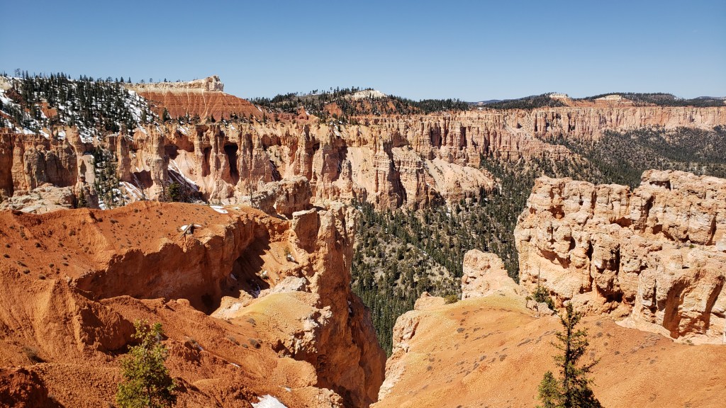
Most of the morning was more hiking on the under the rim trail, the trail we were one since yesterday. We quickly got back into Bryce National Park proper and back to the gentle sometimes not so gentle climbing. There was also some more snow, especially on the east facing slopes. We had run into some yesterday and had a little postholing but it really ramped up this morning.
We kept climbing most of the morning, hitting occasional snow patches which numbed my toes pretty bad. Our first water was at a muddy little fenced off spring that was so goddamn hard to collect from. I kept disturbing the trickle flow and letting mud and debris into the bottle. The mud around the spring was also very deep. Jordan stepped shin deep in one patch and then I went both ankles deep into another. The ground around the spring was a weird dark brown-red color which is probably from the iron in the ground (the spring was named Iron Spring which kinda gave it away).
We hit the junction with Rainbow Point and decided to go up to it and take the shorter way down the rim. Rainbow Point is a lookout point at the southern end of Bryce, accesible by a scenic paved road, which spectacular views of the canyon. It’s at 9114 feet in elevation which I think makes it our highest point since we took the lower altitude alt through the Henrys.
It was pretty dope seeing all we had hiked across over the past day, especially all the little passes and gaps we had gone over. We are lunch and people watched for a bit. Despite it being Sunday, it wasn’t too crowded, though that may be because it’s also Easter.
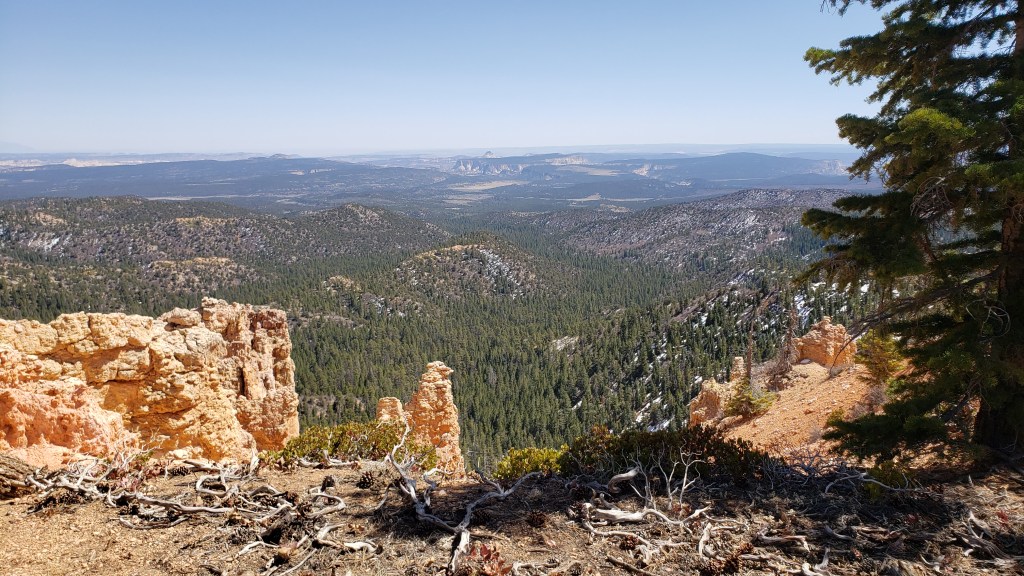
From Rainbow Point we spent the rest of the day hiking mostly downhill, dropping around 1700 feet in 3 miles. Which isn’t that much really but for the Hayduke it’s a big elevation change up to this point. We saw a ranger while postholing but he didn’t so much as say hi when we passed each other.
We found a little piped spring below the pass and filled up there. It took ages to get enough water since I’m still without a filter and we had to share Jordan’s. The next reliable water wasn’t for around 15 miles which meant we’d have to dry camp, not an uncommon occurrence, so we had to camel up.
We followed the trail down some more until it lead us out of Bryce Canyon National Park. So far every national park on this route has been amazing and I definitely want to come back to see them all again some day. Very glad we opted for the extension.
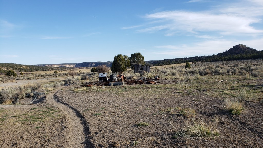
Pretty much as soon as we left Bryce, the trail turned into a dirt road. This section seems to be a mix of BLM land and private property and there’s a ton of dirt roads running all over. The official route had us follow the road for a bit then go a little cross country into a wash. I still have a few trail journals open on my phone and I read the entries for this section. Carrot Quinn’s described it as “dirt road, sandy wash, dirt road”. Like that’s pretty much it. Since we had lit fill of sandy wash back in Hackberry, we opted to stick to the road. Dirt road walking in this section sucks but at least it was kinda faster. We got dusted by a trio of ohvs but that was still probably better than slogging through a sandy wash.
We had dinner by the side of one of the many dirt roads and a bearded dude in four wheeler with a gun on the handlebar rode past with two dogs riding in the back. He pointed and seemed to wink at us as he passed by. Absolute Chad.
We hiked a few more miles to a spring closer than the water source we had oinitially thought was the only reliable one. The spring was flowing so we filled up some more to not have to fill up as much tomorrow. It sucks to carry 4 liters but this section is a little drier and this way I only have to borrow Jordan’s filter once or twice a day.
We struggled to find a campsite again. We left the warm ponderosa pine when we got near the spring and it turned back into shitty sandy slopy exposed shitty desert camping. It took me forever to set up in the not flat but less sloped spot we found. Just as I was peeing before settling in, I looked up at the sky and saw some dark clouds rolling in. God fucking damnit.
The last time I checked the weather in Tropic, it said it was supposed to be clear with no rain but of fucking course you can’t trust that. So I had to adjust everything to pitch my tent just in case. The wind has picked up, not too bad, but enough that I’m worried about that storm coming over us. Goddamn it.
We didn’t do as many miles as I would have liked today even with the mostly flat dirt roads in the afternoon. The late start, climbing, postholing, long lunch, and water filtering really ate up a lot of time so we’re not as close to town as I would like to be. Tomorrow we have 20 ish miles to the highway where we’ll hitch to Kanab. We could hypothetically take out time and camp near the road then hitch in the morning the next day but I want/need a zero so I want to get into town tomorrow. I’m gonna try to rush the 20 and get to the highway asap but we’ll see how it goes.
