Thursday, April 8
27 miles.

New highest mileage day on the Hayduke babbyyy. Helped that all of the miles were on trail or dirt roads.
We were in a weird area where sometimes our phones would be getting data from towers in Arizona and sometimes from towers in Utah so the time kept changing. We woke up around sunrise which in Utah was around 7am but in Arizona was 6am. This was very disorienting and made for a harder day since it through off our usual schedule.
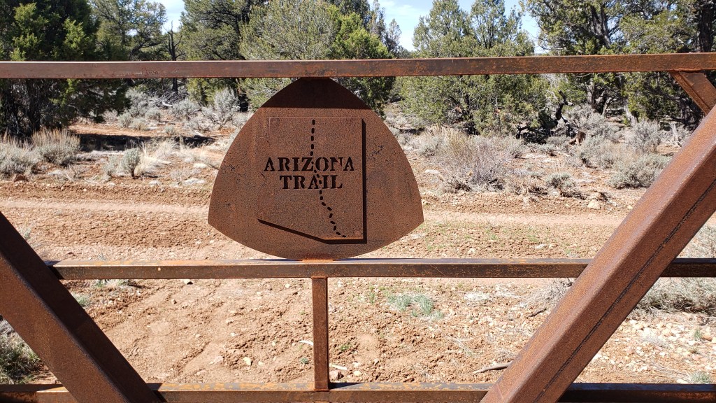
After whenever we woke up, we started hiking on the AZT sobo. We hit some long swooping switchbacks up to the Kaibab Plateau. Because they’re graded for bikes, the switchbacks were pretty gradual and easy to climb up. Helped that we did them early before the day warmed up. Some nice views of the Vermillion Cliffs go our east too.
Once up on the plateau we were mostly in forests with some easy rolling hills on and off. We stopped to get water twice, both times at two “tanks”, basically rain catchment systems that pour into concrete basins. The water was super scummy and filled white fibers that Jordan said clog up filters quick so we had to pre filter. The lifestraw filter I have is so annoyingly low volume. It takes forever to filter water with it since I have to keep refilling it. It’s still fairly fast but I’m probably going to have to attach it directly to my bottles instead of using the soft flask if came with.
The hiking was fine, not very scenic though not that I expected it to be. Today and the next two days are going to be more functional than rewarding as we make our way to the Grand Canyon. Around 10 miles I also realized that the Hayduke mileage is wrong here. The Hayduke says 24 miles between Stateline and Highway 89 but the actual AZT mileage is 27 miles. The Hayduke was created before the AZT was finished so the mileage are all probably off for this section. Bonus miles woooo.
We hiked until we hit a trail closure. There was a fire here a few years ago and the trail was closed for a couple of miles. We didn’t know about this closure and had purposefully not carried too much water because we thought there was going to be a water source not far. Unfortunately, that water source was within the closure. The next sure water was at the highway, 10 miles away. Jordan and I both only have a liter and a half and Jack had 2 which we figured would have to be enough (it was).
The map on the closure notice indicated the detour was on a dirt road that veered a bit west of the AZT. Between the AZT and the road on the map was another dirt road that looked shorter. We debated which one to take (I wanted to take the shorter one, duh) but we settled on the official detour on the map since we figured there was probably a reason for that road. Turns out the actual marked detour was the shorter road after all.
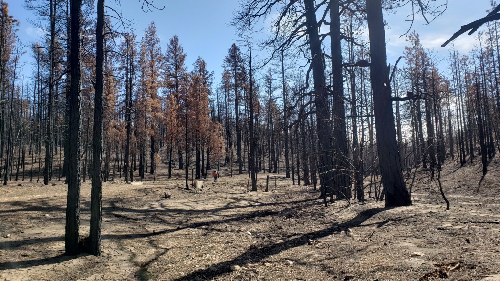
This dirt road section sucked. It went right through the burn area and was really windy so we kept getting ash and dust blown at us constantly. We went passed a few tanks but most were empty. One had a few inches of disgusting brown water that I got a half liter out of but never drank. The hike through the burn area was kinda cool. It’s definitely much different than what we’ve hiked through so far and the burned trees are so dark and ominous, like a haunted forest out of a fairy tale. I’ve hiked through a ton of burn areas on the PCT and CT but it still never sees to make me appreciate the destructive power of nature.
I tried to keep my mouth closed as much as possible while we hiked through there but I still ended up inhaling a ton of dust and ash. A few miles from the highway I started feeling like absolute trash and started coughing my lungs off. I’m guessing my post covid lungs can’t handle ash and dust too well. I felt super nauseous and ended up hurling off the side of the road. The water I had was gross tank water that tasted a bit like pond scum and that didn’t help the nausea. After throwing up I did feel a bit better though like maybe I cleared some of the ash out.
We made it to the highway and our second to last cache fairly early, or at least earlier in Arizona. We found the spot where we buried out buckets but could not find them. We kept digging around near where we left them but didn’t find them. We actually started to worry someone found them and got rid of them which would be very bad. After tearing apart the area we buried them for way too long, we found them safe and sound.
We fixed up the mess we made, filled up with good water from an AZT hiker water cache, and headed up a hill to where we are now. It was still early when we set up so Jordan and I sorted and repacked our cache food. We have 7 days of food which is going to really suck to carry but at least there’s more water the next few days. Tomorrow we’re going to head to the Jacob Lake Inn early to get breakfast, charge up our batteries, and get any last minute snacks before heading off into our longest section between towns.
The AZT hikers we met yesterday said the snow between Jacob Lake and the North Rim was terrible and they postholed for miles before just doing the road walk so I am of course anxious about that. I watched String Bean’s AZT FKT videos before we left Kanab. He just broke the FKT a few days ago and at one point actually quit because of the snow which did not inspire confidence. His team postholed through the snow for him to clear a path so maybe that’ll still be there for us. Jordan thinks the warmer weather will melt it quick but I’m skeptical. I really don’t want to spend two days postholing when there’s a perfectly good road walk right next to the trail but as always we’ll see.
